


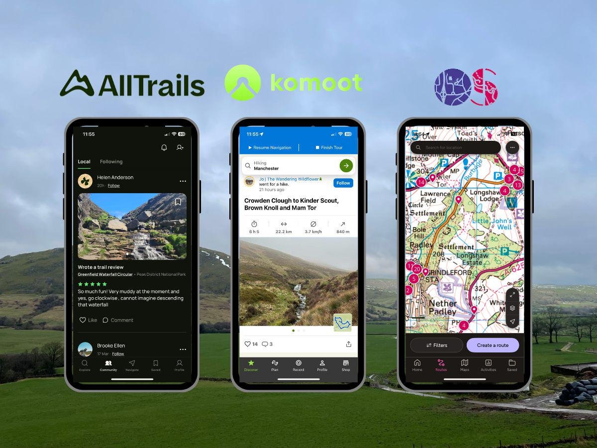
Digital navigation tools have transformed the way outdoor enthusiasts plan and execute their adventures. Long gone are the days of relying solely on paper maps, as apps like Gaia GPS, CalTopo, and AllTrails offer innovative features designed for a variety of hiking styles. These platforms provide functionalities such as route planning, shared trail insights, and detailed map layers, making them valuable companions for trips through both well-known routes and more remote areas.
Each app caters to specific needs, from trail popularity to technical mapping capabilities. For example, CalTopo offers customizable map layers for advanced users, while Gaia GPS is noted for its detailed topography and ease of use. Popular among hikers, AllTrails ranks high due to its accessibility and widespread trail database. Exploring these tools can help adventurers optimize their hikes and prepare more confidently for the challenges ahead.
Key Takeaways
- Navigation apps simplify route planning and enhance trail exploration.
- Features vary between platforms, tailoring options to user needs.
- Digital tools complement traditional methods, offering real-time insights.
Planning Your Route
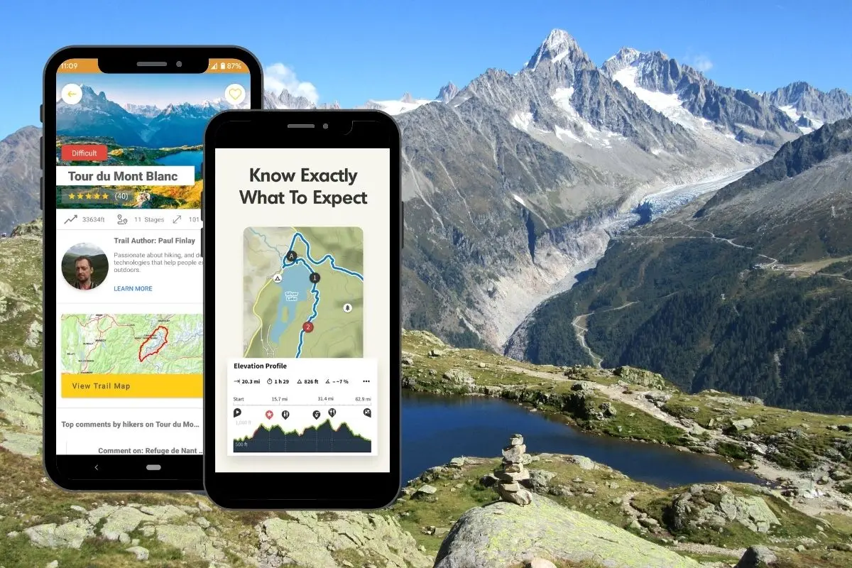
Choosing the right trail and preparing for the journey are crucial for a safe and enjoyable hiking experience. Tools like AllTrails, CalTopo, and Gaia GPS offer valuable features for creating and customizing hiking routes. Each tool caters to different needs, making them suitable for various skill levels and preferences during route planning.
Key Considerations for Trail Selection
- Trailhead Location
Start by identifying a convenient trailhead. Consider parking availability and proximity to amenities, such as restrooms or water sources. - Trail Conditions
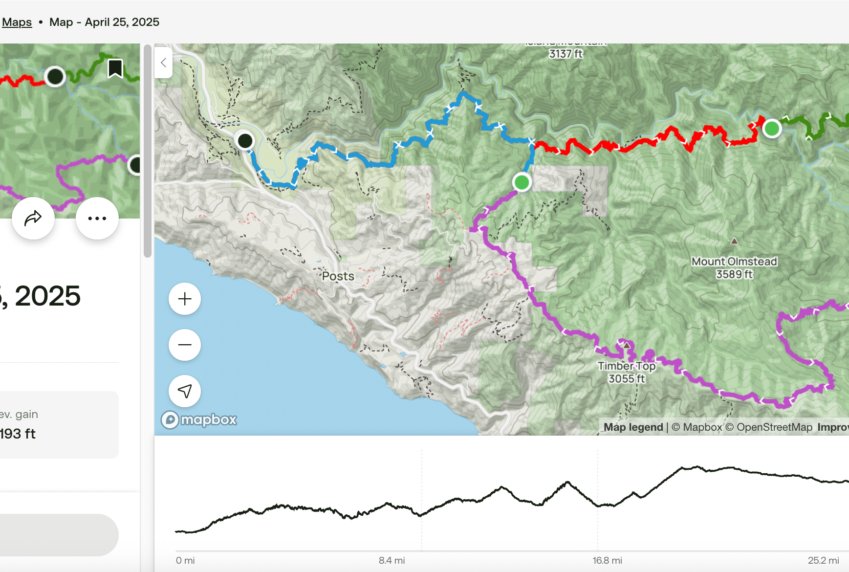
Check for updates on trail conditions. Overgrown paths, fallen trees, or water flow levels can significantly impact your hike. Trail reports on platforms like Big Sur Trail Map may identify potential issues early. - Distance and Elevation Gain
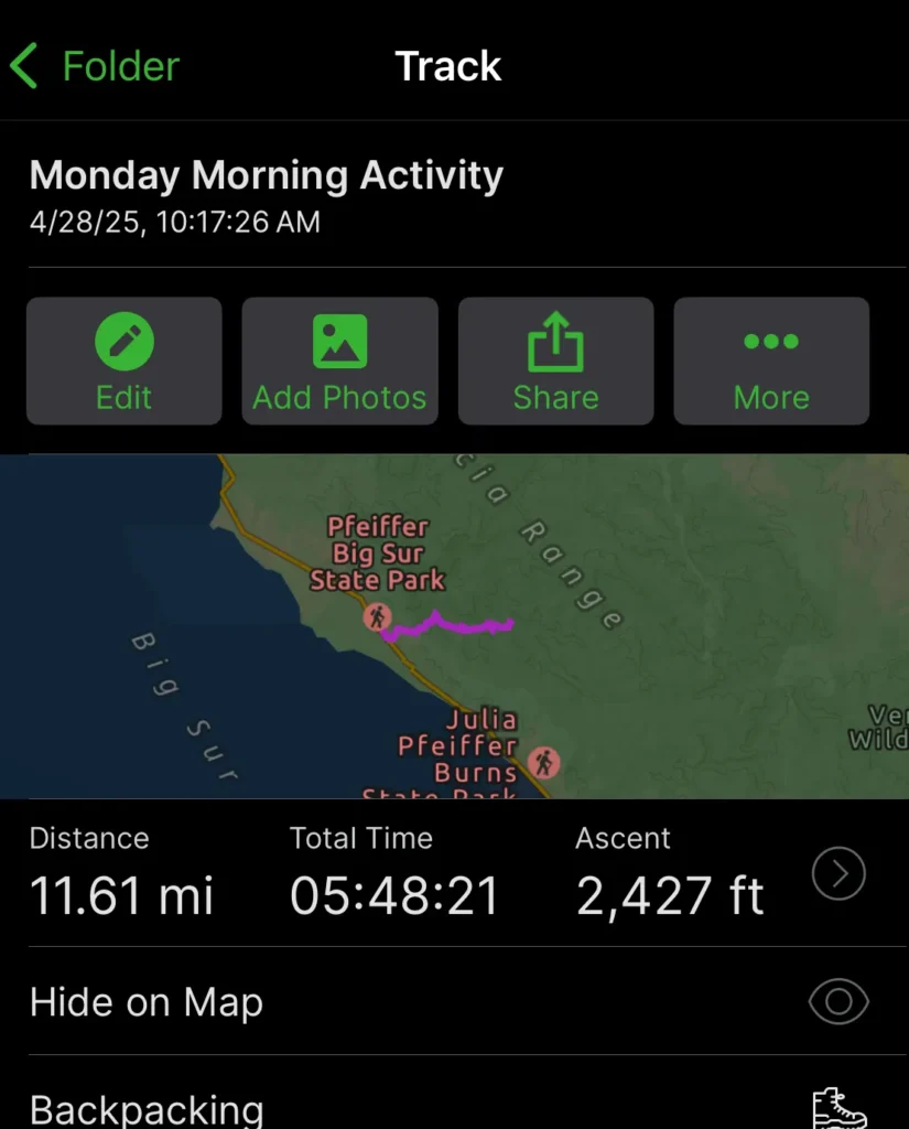
Estimating distance and elevation gain is critical for pacing yourself. Depending on the planning tool you use, data may vary slightly. For example, AllTrails might mark a trail as 32.8 miles, while CalTopo and Gaia may estimate it as longer or shorter. Elevation gain metrics can also vary widely, so compare results across platforms. - Stops and Campsites
For multi-day hikes, map out planned stops. Popular campsites like Sykes Camp or Rainbow Camp may provide strategic stopping points, offering rest opportunities after tackling steep terrain.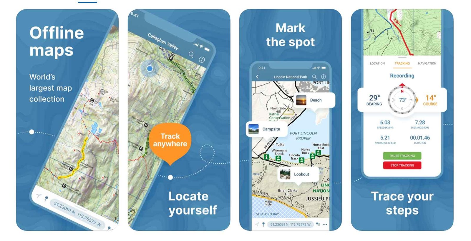
avenza maps hiking app 1
Building Your Route
Route mapping tools simplify the planning process by letting you visualize your journey. Each has specific advantages:
| Tool | Strengths | Challenges |
|---|---|---|
| AllTrails | Easy to use and intuitive route editor | No route creation available on mobile devices |
| CalTopo | Best for advanced customization with multiple layers | Requires precise clicks; less user-friendly |
| Gaia GPS | Good snap-to-route functionality | Editing routes after creation can be frustrating |
Using a combination of these tools can provide overlapping insights, helping to refine your trail plan while ensuring accuracy.
Tips for Mapping Tools
- Enable topographic maps to understand elevation changes.
- Utilize overlays like vegetation density or water sources to identify features such as steep terrain or potential hazards like overgrown areas.
- Separate each day’s hike into distinct map layers with tools like CalTopo to better track progress.
Preparing for Unexpected Issues
While tools streamline planning, real-world variables can present challenges. Detours, unpredictable weather, or encountering poison oak and ticks are common in backcountry environments. Comments and reviews from other hikers are valuable for up-to-date advice. For instance, a suggestion to stop at Timber Top for its scenic view might enrich your journey, even if it adds to the route.
If technology fails, rely on traditional tools like a compass and printed topographic maps. These backups are critical, especially in areas with limited cellphone reception.
Efficient Planning Devices
Using a computer is often the easiest approach for route creation. Larger screens and precise tools like a mouse allow for smoother navigation and adjustments. While applications such as CalTopo and Gaia GPS support mobile editing, their interfaces can be less reliable on small screens, potentially leading to errors.
Thorough route planning ensures a balanced and enjoyable hike, whether it’s for a short trek or an extended loop like the Big Sur Sykes Hot Springs trail. Integrating digital tools with knowledge of the terrain and natural elements prepares hikers to navigate confidently and safely.
Why Rely on Apps While Hiking?
Modern hiking tools like smartphone apps can greatly simplify navigation and route planning. They complement traditional methods such as paper maps by offering features that improve accuracy, reduce preparation time, and enhance convenience.
Advantages of GPS and Smartphone Apps
Precise Location Tracking: GPS-enabled apps display your exact location on the trail through features like the familiar blue dot. This eliminates the need to determine your position manually, saving time and effort during your journey.
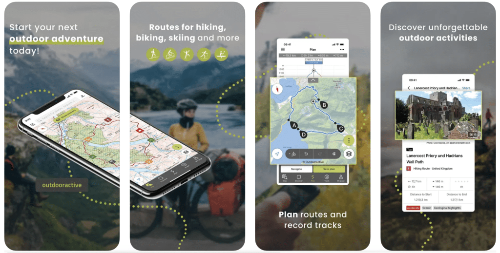
Dynamic Route Planning: Many mapping apps provide “snap-to-route” tools, which allow users to create routes that align perfectly with established trails. These tools are helpful in avoiding errors while planning complex or multi-step routes.
Offline Map Access: Premium services for apps such as Gaia GPS, CalTopo, and AllTrails allow hikers to download map layers for offline use. This ensures reliability, even in areas without cell service.
Trail Information: Many apps leverage crowdsourced data to inform hikers about weather conditions, trail obstacles, and safety tips from other users. This community aspect can be invaluable and is difficult to replicate with traditional tools.
Drawbacks to Consider
While hiking apps are useful, they come with tradeoffs. These include battery depletion, the need for chargers, potential hardware malfunctions, and privacy concerns due to shared location data. Addressing these limitations by carrying basic backup tools, such as a printed map or compass, is a dependable strategy.
Summary of Practical Advice
Hiking and backpacking demand thorough preparation to ensure safety and enjoyment. Whether navigating trails, responding to unexpected wildlife encounters, or dealing with weather changes, being well-equipped and informed is essential.
- Navigation Tools: While GPS apps like AllTrails and Gaia provide route details and tracking features, they may contain inaccuracies. It is critical to carry a physical map and compass as backups to avoid reliance on digital tools that could fail. Apps with detailed topographical data, such as CalTopo, can enhance planning but should not replace offline methods.
- Essential Gear: A dependable headlamp with fresh batteries is crucial, as nightfall can come earlier than expected. Bring trekking poles to help manage uneven terrain and reduce joint strain. Additionally, pack a VHF radio for areas with limited cell service; it can be a lifesaver in search-and-rescue situations.
- Water and Food: Extra water and high-calorie snacks are non-negotiable. Uncertainty in trail data or prolonged hikes can lead to extended outing times, emphasizing the need to carry more than the minimum. In situations where carrying additional supplies adds weight, use compact solutions, such as water purification tablets.
- Wildlife Awareness: Encounters with animals like black bears are possible. Familiarize yourself with safe practices, such as utilizing bear-resistant containers for food storage. Making noise while hiking can prevent startling wildlife, but in case of an approach, remain calm and back away slowly.
- Weather Preparedness: Unpredictable conditions, such as a sudden thunderstorm, can turn hikes into hazardous events. Carry lightweight shelter options like a bivy sack or emergency tarp. Waterproof outer layers are also essential to stay dry and warm.
- Time Management: Always estimate hiking times conservatively. Account for elevation changes and potential breaks. Monitor your pace to keep within daylight hours, reducing the risk of navigating in the dark.
Gear Checklist
| Gear | Purpose | Notes |
|---|---|---|
| Headlamp | Night visibility | Ensure batteries are fully charged. |
| Shelter | Emergency cover | Lightweight options are ideal. |
| Trekking Poles | Stability and support | Reduces strain on knees and back. |
| Extra Water | Hydration | Add purification tools if resources permit. |
| VHF Radio | Communication | Useful in areas without mobile signals. |
This level of preparedness helps to balance convenience with safety, making any outdoor adventure more manageable.
Frequently Asked Questions
What distinguishes CalTopo from Gaia GPS in backcountry navigation?
CalTopo is often praised for its advanced mapping tools and customization options, such as layering maps and editing routes online. This platform excels for creating routes and exporting them to other devices. Gaia GPS, on the other hand, allows hikers to create routes directly within its mobile app, offering convenience for those who prefer working on the go. CalTopo’s versatility in map creation is frequently highlighted, while Gaia GPS earns points for user-friendly mobile interface and offline navigation capabilities.
How does OnX Backcountry measure up against other GPS apps for hikers?
OnX Backcountry is known for features tailored to exploration, like its detailed trail maps, marked public land boundaries, and offline mode capabilities. Though slower in certain map functions compared to Gaia GPS, it appeals to backpackers seeking comprehensive backcountry data. For example, tools to navigate hunting zones and private property edges give it an edge when used in combination with platforms like Gaia GPS, which specializes in user-friendly hiking data.
What subscription options and features does CalTopo offer?
CalTopo subscriptions range from free to premium tiers, with the higher tiers adding features like advanced map sharing, unlimited offline layers, and high-resolution print maps. The free version provides basic mapping tools, but premium upgrades unlock extensive route planning resources sought after by experienced hikers. CalTopo’s paid levels cater to users who need precise map customization and expansive offline support.
Which Gaia GPS features are highlighted in reviews for hiking efficiency?
Gaia GPS stands out for its diverse map layers, reliable offline navigation tools, and extensive community-driven trail data. Reviews emphasize its ability to provide unique map details, such as crowd-sourced routes and user-submitted trail information. Although some users note slower performance in certain situations, Gaia GPS remains popular among backpackers who value its layered mapping capabilities and easy-to-use design.
Is there an affordable GPS app suitable for avid hikers?
For those looking for cost-effective navigation tools, Gaia GPS and CalTopo both offer competitive pricing and free versions with robust features. AllTrails is another option with a user-friendly interface tailored to casual hikers. While free options work well for basic planning, budget-conscious backpackers can benefit from Gaia GPS’s moderate subscription rates, ensuring access to advanced layers and offline trail data. Gaia GPS is often mentioned in discussions about affordable but functional tools.
What benefits does CalTopo have compared to physical trail maps?
CalTopo provides an array of digital tools that surpass traditional paper maps. These include real-time data updates, layered map customization, and route planning capabilities accessible across multiple devices. Backpackers appreciate its flexibility and ability to generate targeted trail maps that can be tailored to specific needs. Unlike paper maps that remain static, CalTopo ensures adaptability in navigating complex terrains.

